Eastern United States Caribbean Central America 1854 German large detailed map
Eastern United States Caribbean Central America 1854 German large detailed map


Couldn't load pickup availability
-
Ordered
- - -
Order Ready
- - -
Delivered

Eastern United States Caribbean Central America 1854 German large detailed map
...(Amer)ika, nebst Mexico und Central America.
(Eastern United States, Caribbean, West Indies, Yucatan, Cuba, Antilles, etc.).
Issued Leipzig, Germany, 1854 by J.C. Hinrichson for Stein. Engraved by R. Schmidt, H. Eberhardt & v. Boehr.
Fine and quite uncommon oversized folio sheet mid-19th century antique map. Engraved map with original outline hand color.
Map constitutes one-half of a larger, two-sheet map.
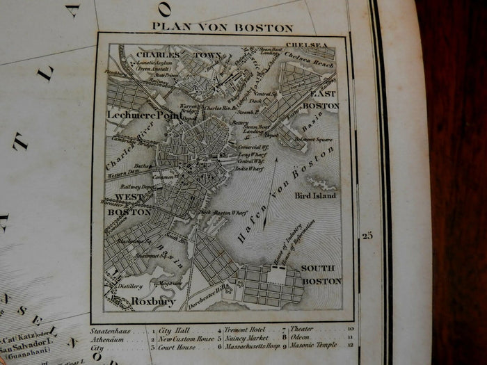
Of note for the detailed inset city plan of Boston along right side margin which includes a key below identifying 12 specific buildings including the Masonic Hall, theatres, etc. Also features numerous shipping and travel routes along the Atlantic Ocean with distances between locations. Belize is named as a British Colony.
Paper is uniformly age-toned with darkening around the edges; light scattered spotting; otherwise clean. A very scarce large folio sheet map.
Original tri-fold lines as issued.
Sheet measures c. 20 3/8" x 16 3/4".
Engraved area measures c. 24 1/2" x 15 3/8".
Tooley's Dictionary of Mapmakers , vol. II, pg. 335.
[R21072]
🔒 Order with Confidence
🔒 Order with Confidence
✅30-Day Money Back Guarantee — no risk trying it.
🚚Free shipping available. Orders processed within 24–48 hours.
🔐Secure & encrypted checkout with trusted payment providers.